Google Earth AI Feature Paused Over Deepfake Fears
Google launched a new AI tool inside Google Earth, then switched it off in about a day. The feature let anyone create AI images on top of real satellite maps. Within hours, researchers showed it could fake events that never happened. Google paused it to add stronger safety controls.
At aiera.blog, we track how AI shows up in the products people use every day. This story is a clear example of a powerful tool meeting a hard limit. Below, we break down what the Google Earth AI feature did, why Google pulled it so fast, and whether it will return. You will also learn how to spot fake satellite images, so you are not fooled by them.
What the Google Earth AI Feature Actually Was
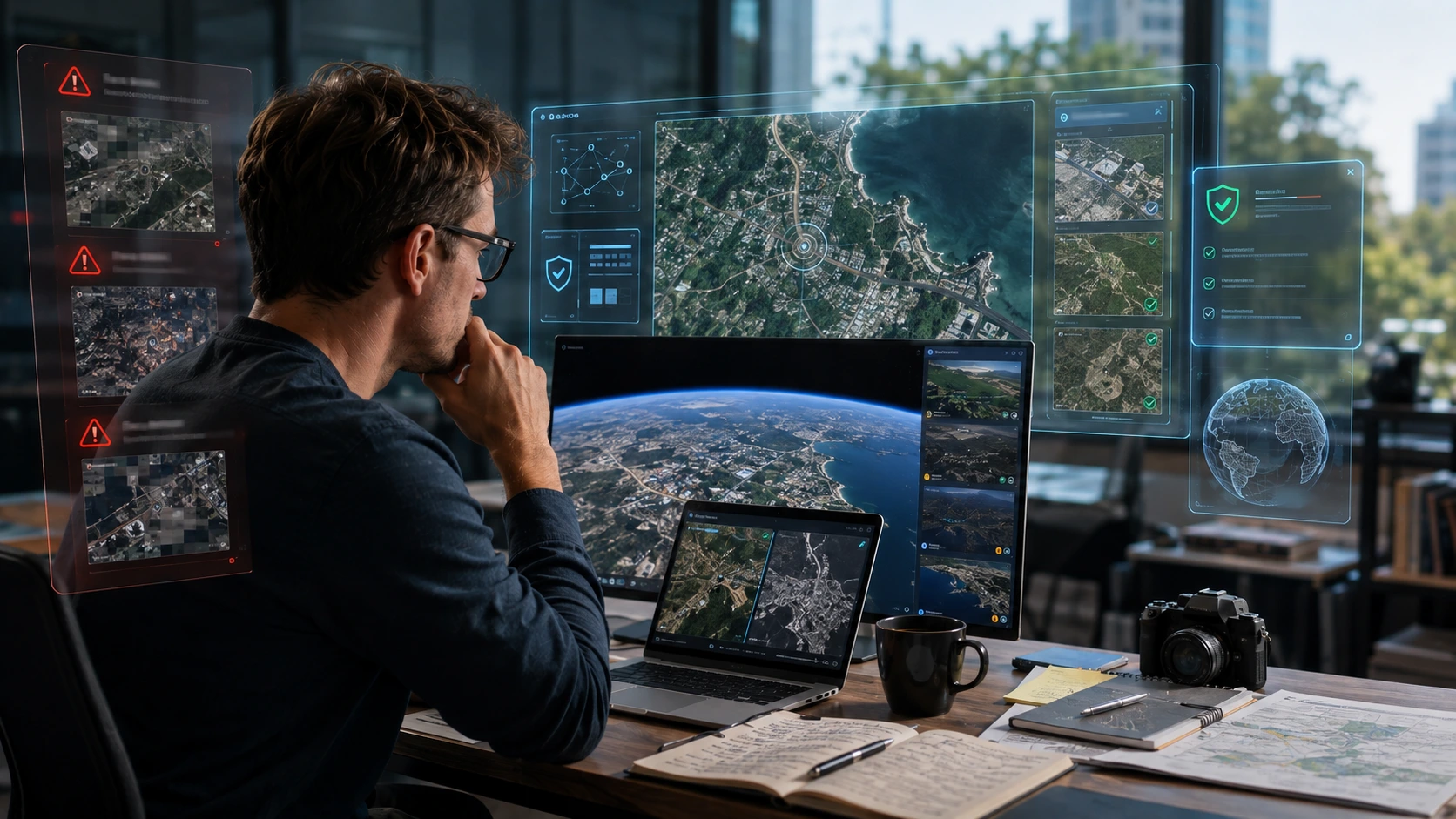
On Thursday, July 30, 2026, Google added a “Create image” tool to Google Earth on the web. The idea was simple. You zoom in to any place, tap “create image,” type a prompt, and the tool generates a picture based on that spot. It worked with Google’s satellite, aerial, and 3D map views.
Google promoted the feature as a way to reimagine real places. It suggested useful cases such as previewing construction projects, planning real estate and urban spaces, showing historical scenes, and building educational visuals. In short, it turned Earth from a tool for viewing places into a tool for imagining them.
The tool ran on Nano Banana 2, Google’s fast image-generation model. Every generated image carried an AI watermark. The images were also user-created and kept separate from the main, public Google Earth view. So the pictures did not replace the real map for everyone else. They lived in the individual user’s session.
A Quick Look at Nano Banana 2
Nano Banana 2 is Google’s upgraded image model, technically known as Gemini 3.1 Flash Image. It is built for speed and quality at the same time. It can produce sharp images up to 4K, render clean text inside pictures, and handle detailed prompts. Google made it the default image model across the Gemini app. Putting a model this capable inside a trusted map product is exactly what made this launch interesting, and risky.
If you want a wider view of the tools in this space, our guide to the best AI image generation tools in 2026 covers the main free and paid options.
Why Google Paused the Feature
The problem showed up almost immediately. The same tool that could preview a new park could also invent a disaster that never happened.
Misinformation and open-source investigator Henk van Ess tested it fast. He generated realistic but completely fake scenes, including a fictional nuclear facility in Iran, a refugee camp that did not exist on the US–Mexico border, and a damaged hospital in Gaza. None of these were real. Yet they looked convincing, and they sat on top of Google’s real, trusted map imagery.
Other voices joined the criticism. Alex Hirsch, creator of Gravity Falls, argued that tech companies keep forcing generative AI into products without asking whether people actually want it there.
Google responded within a day. The company said geospatial professionals had used the feature for helpful work. But it also admitted that people were sharing screenshots of generated imagery that appeared to break its policies. So Google rolled the feature back while it worked on stronger guardrails. Product manager Bryan Horowitz had introduced the tool as a way to spark imagination. One day later, that same freedom was the reason it was switched off.
The core issue was not image quality. It was trust. When fake images ride on a map people rely on for the truth, the map itself loses value.
Timeline: From Launch to Rollback
Here is how fast the whole thing moved.
| Date (2026) | What Happened |
|---|---|
| Jul 30 (Thu) | Google launches the “Create image” AI feature in Google Earth on web |
| Jul 30–31 | Researchers demonstrate fake satellite scenes, including invented disasters |
| Jul 31 (Fri) | Google suspends the feature and promises stronger guardrails |
From launch to pause was roughly 24 hours. That is a very short life for a feature from a company as large as Google. It signals how seriously the company treated the risk.
Why This Pause Matters More Than a Normal Product Delay
Most paused features are about small bugs or slow performance. This one was different, because of where the tool lived.
Satellite imagery is a trust anchor. Journalists use it to confirm breaking news. Open-source investigators use it to verify events in hard-to-reach places. Emergency responders and researchers use it to understand the ground before they act. For years, a satellite view has been treated as strong evidence that something is real.
An AI generator inside that same product changes the deal. If anyone can paint a fake explosion, protest, or military site onto a real location, then satellite screenshots stop being proof. Worse, the fake borrows Google’s credibility. A viewer sees the familiar Earth interface and assumes the image is trustworthy. That is why researchers reacted so strongly. Once the credibility of satellite imagery is damaged, it is very hard to rebuild.
The Bigger AI Governance Question
This is really a governance story. The technology worked. The safeguards, like watermarks and separate storage, existed. They were simply not enough for a product where trust is the whole point.
That gap between “the model works” and “the rollout is safe” is now central to how large companies reshape their products around AI. We saw a related shift in how big tech is reorganizing work around AI at Meta, where speed and scale collide with real-world impact. The lesson repeats: capability alone is not readiness.
Regulators are watching this closely too. As AI moves into sensitive fields, oversight is growing. Our coverage of the first regulated AI law firm shows how formal rules are starting to catch up with AI in high-trust settings. Maps that shape public understanding of real events may face similar pressure.
A Familiar Pattern: Google Ships Fast, Then Pulls Back
This is not the first time Google has launched an AI feature and then reversed course under pressure.
In February 2024, Google paused Gemini’s ability to generate images of people. The model had produced historically inaccurate results, and the backlash was swift. Around the same period, Google’s AI Overviews in Search drew criticism for giving strange or wrong advice, forcing quick fixes and rollbacks.
The Google Earth pause fits the same shape. Ship a bold AI feature fast, face public testing in real time, then make emergency changes when problems appear. This “launch first, adjust later” approach can help a company move quickly. But in trust-critical products, it carries real risk. When the product is a map that people treat as fact, the margin for error is thin.
How to Spot AI-Generated Satellite Images
Even with this feature paused, fake satellite images will keep spreading across social media. Here is how to protect yourself.
- Look for AI watermarks or labels. Google’s tool added watermarks, and many AI systems embed hidden signals like SynthID. A missing or edited watermark is a warning sign.
- Cross-check with a second source. Compare the image against another map provider or a dated, official satellite source. Real events usually appear in more than one place.
- Check physical logic. Study shadows, scale, and structure. Impossible layouts, odd lighting, or buildings that do not match the known area often reveal a fake.
- Be skeptical of dramatic “proof.” If a shocking satellite image spreads fast with no trusted outlet confirming it, treat it as unverified until a reliable source backs it up.
These habits matter more each year, as AI images get harder to tell apart from real ones.
Will the Google Earth AI Feature Come Back?
Google framed the pause as temporary, not permanent. The company said it was adding stronger guardrails, which suggests it wants to relaunch a safer version.
If the feature returns, expect tighter controls. Likely additions include stronger and harder-to-remove watermarking, limits on sensitive locations and coordinates, and stricter filters that block fake disasters, conflict scenes, and other high-risk content.
To be clear, Google has not confirmed a return date. So the honest answer is that a comeback looks possible, but nothing is promised. Watch for an official Google announcement that names specific safety measures. That would be the real signal that the tool is coming back in a more controlled form.
Frequently Asked Questions
Why did Google pause the Google Earth AI feature? Because users showed it could create convincing fake satellite images that appeared to violate Google’s policies. Google paused the feature to add stronger safety guardrails.
What is Nano Banana 2? Nano Banana 2 is Google’s fast, high-resolution image-generation model, technically called Gemini 3.1 Flash Image. It powered the Google Earth “Create image” tool.
Were the AI images visible to everyone in Google Earth? No. Google said the images were user-created, carried AI watermarks, and stayed separate from the public Google Earth view.
Why are fake satellite images dangerous? They can fake “evidence” of events that never happened, such as attacks or disasters. This undermines a tool that journalists and investigators rely on to verify real news.
Is the Google Earth AI feature coming back? Google called the pause temporary while it builds stronger guardrails, but it has not confirmed a return date.
Final Thoughts
The Google Earth AI feature launched with a bold promise and paused within a day. The reason was not weak technology. It was the danger of mixing a powerful image generator with a map the world trusts as real. Google chose to protect that trust, at least for now.
The wider takeaway is simple. AI features in trust-critical products need strong guardrails before launch, not after the damage is done. As models get faster and more realistic, that lesson only grows more important.
For more clear, no-fluff breakdowns of AI news and tools, keep following aiera.blog. We test it, review it, and explain what it means for you.